
 |
|
GIS / Cartography
|
||
 |
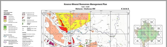
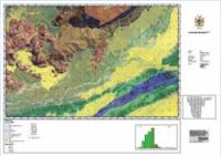
We collect and process thematic spatial data, for example in the following topics: habitat types, soil types, land use, geology, hydrogeology, raw materials, agriculture, forestry, land use planning. We organise this data in modern databases and geographic information systems.
Via modern geographic information systems, we offer professional support in all steps of mapping, starting with the processing of raw data up to the compilation of high-quality cartographic output thematic maps in PDF/X3-files on screen or as CTP(computer-to-plate)-prints. |
|
 |
For the digital submission of analogue documents, scanners are available up to size A0+ and larger.
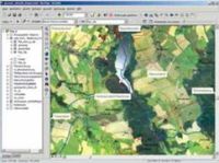
In addition to the digital delivery of printable results, we provide prints of small print runs directly from our plotters. Our user interfaces guarantee easy and intuitive utilisation of the data in customised geographic information systems. |
|