| Manganese Nodule Resource Estimation Completed |
| 14th December 2010. Hannover |
|
The estimation of Mn-nodule reserves at the sea floor in a part of the German License area has been successfully completed. Based on the results of selected samples and the bathymetric and backscatter data, several models for Mn-nodule distribution have been calculated and applied in order to estimate the total reserves and the accurate spatial distribution of the nodules. The developed model has a resolution of 100 meters and represents the Mn-nodule distribution within an area of 19,000 sqkm. Once more advangeo® has shown its strengths in complex data analysis and interpretation. The project was executed as a contract on behalf of the German Federal Geological Survey (BGR).
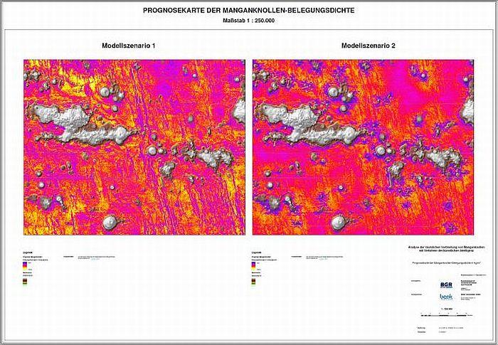
For more information about manganese nodules research at the International Seabed Authority (ISA) please see publications. Here you can see part of the created prognosis map for manganese nodule coverage density. Detailed information and map can be obtained through BGR. |
| Prognosis Map of Manganese Nodules Coverage Density, Model Scenarios 1 and 2 |

|

